Nelspruit
Mbombela, also known as Nelspruit, is a city in northeastern South Africa. It is the capital of the Mpumalanga province. Located on the Crocodile River, The city lies about 110 km by road west of the Mozambique border, 330 km east of Johannesburg and 82 km north of the Eswatini border. The city was one of the host cities of the 2010 FIFA World Cup.
San rock art and Iron Age archaeological evidence indicate the area has a long history of human habitation. Construction for the Mpumalanga legislature revealed farming settlements, storage pits, burial sites, and pottery ranging from the 6th to 17th century. The presence of cattle bones at the Riverside site is thought to be evidence that early Nguni practices of labola originated in eastern South Africa.
The city was founded in 1895 by three brothers of the Nel family who grazed their cattle around the site in the winter months. During the Boer War, Nelspruit served briefly as the seat of government for the South African Republic, an independent Boer republic (not to be confused with the Republic of South Africa).
The settlement was a key stopover for the Eastern Railway built by the Netherlands-South African Railway Company in the late 19th century which ran from the newly discovered Witwatersrand goldfields to Delagoa Bay in Portuguese East Africa (modern-day Maputo, Mozambique). The discovery of gold in Mpumalanga, such as at Pilgrim's Rest and Barberton, encouraged further development.
The history of Nelspruit occurred along segregated lines. Under Apartheid’s policy of separate development, Black people were forcibly removed from the town to Lekazi, Kanyamazane, and other outlying areas as menial labour reserve. In the early 1970s, Nelpark was formed as a Coloured district and Valencia as an Indian area in the town. Youth centres, public amenities, and schools such as Nelspruit Laerskool were reserved for the town’s white population.
Map - Nelspruit
Map


Country - South_Africa
 |
 |
| Flag of South Africa | |
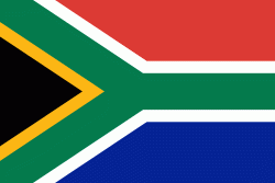
About 80% of the population are Black South Africans. The remaining population consists of Africa's largest communities of European (White South Africans), Asian (Indian South Africans and Chinese South Africans), and multiracial (Coloured South Africans) ancestry. South Africa is a multiethnic society encompassing a wide variety of cultures, languages, and religions. Its pluralistic makeup is reflected in the constitution's recognition of 11 official languages, the fourth-highest number in the world. According to the 2011 census, the two most spoken first languages are Zulu (22.7%) and Xhosa (16.0%). The two next ones are of European origin: Afrikaans (13.5%) developed from Dutch and serves as the first language of most Coloured and White South Africans; English (9.6%) reflects the legacy of British colonialism and is commonly used in public and commercial life.
Currency / Language
| ISO | Currency | Symbol | Significant figures |
|---|---|---|---|
| ZAR | South African rand | Rs | 2 |
| ISO | Language |
|---|---|
| AF | Afrikaans language |
| EN | English language |
| ST | Sotho language |
| SS | Swati language |
| TS | Tsonga language |
| TN | Tswana language |
| VE | Venda language |
| XH | Xhosa language |
| ZU | Zulu language |